An exercise I had wanted to accomplish in Dr. Graham’s HIST 3814 was Module 4’s Simple Mapping and Georectifying. This involves taking a map and using the Harvard World MapWarp website to display the map as a layer above a map of the Earth from today, such as Google Maps. The website uses specific points that the subject map shares with today’s map and “warps” the subject map to match the scale, projection and location of the map from today. There are all kinds of uses for this.
One of them is plotting the locations from Richard Adams’ Watership Down. Mythgard.org has an excellent page of locations from the book based on the map below. As a young reader, I remember plotting the location of Watership Down on my National Geographic map of Great Britain in pencil. However, I missed a key fact. In this map, the direction north is left, not up.
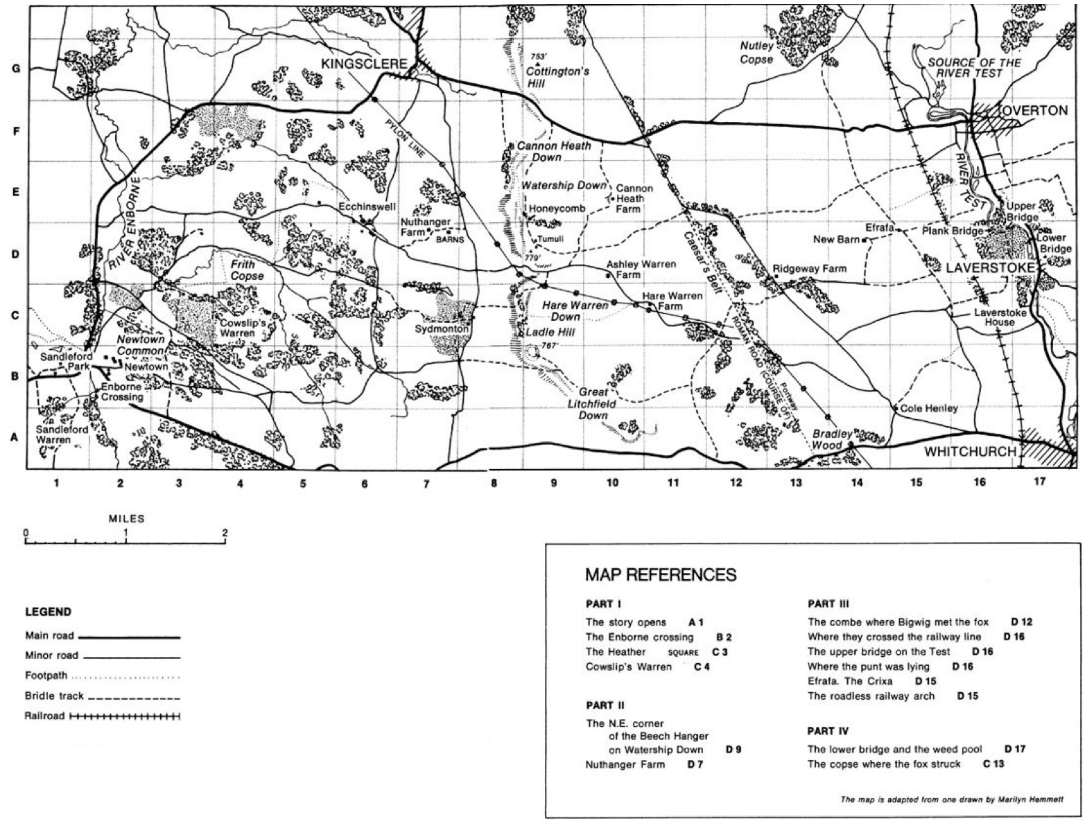
Despite the orientation of the map, it is easy to select and plot locations from this map from circa 1972 to a map of this part of England today. While there are new roads, the courses of rivers, pylon lines and railroads remain. Even the old Roman road, Caesar’s Belt, is still visible on today’s map. Here is the resulting map.
Plotting the railway map of the Kingston and Pembroke Railway.
During HIST 2809, I completed an assignment comparing two railway maps from the 1890’s. One of them was the Kingston and Pembroke Railway (K&P) that travelled between Kingston and Renfrew, Ontario. Much of the area that the K&P traversed is now wilderness and the former railway is now a trail and so plotting the many stops the K&P had in 1899 on a map from today is an interesting comparison. Here is the resulting map.